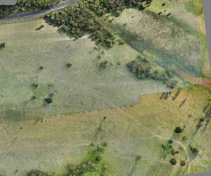
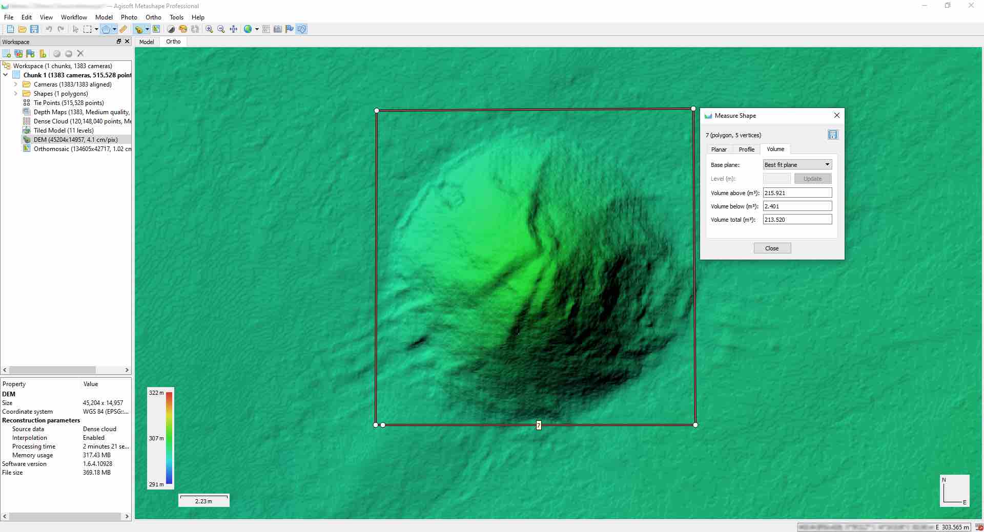
Plateway has an extensive engineering surveying capability. By combining our optical, GNSS and aerial-based mapping methods, we are able to capture complex landscapes and generate accurate high resolution 2D and 3D survey data for use in designing and monitoring works. Plateway is committed to providing professional, efficient, and detail-oriented results.
Advantages of UAV Mapping
Aerial mapping with a zoom capability enables access to complex and risky hazardous locations from a safe distance. Conducting aerial surveys will not require closure of tracks or interruptions to construction works.
Capturing data with a drone is substantially more time efficient and requires less manpower providing significant reductions in time and costs associated with large scale surveying projects.
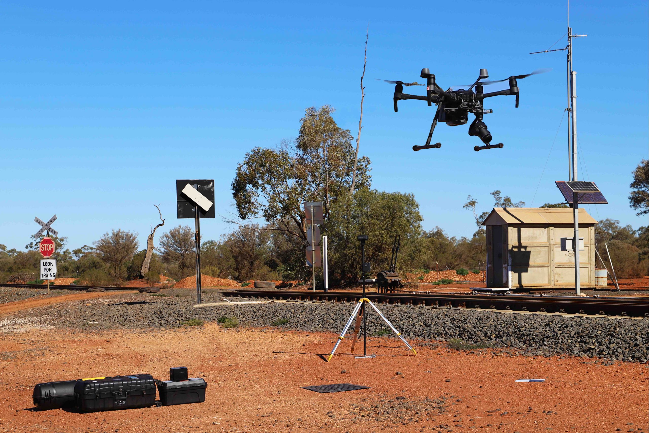
Our DJI Matrice 210 RTK Drone, in combination with its base station and the HIPER V GNSS System allows for high precision results even in remote locations with no access to a mobile network or permanent marks.
Plateway operates a mobile workforce with the capability to travel to remote locations Australia-wide. Our mine-spec utility vehicles are fully equipped for both urban and remote locations.